Nauru has no grand monuments or resort strips, and that is exactly what makes its handful of sights memorable. The island is small enough to see most of it in two or three days, and each stop tells part of a bigger story about coral, phosphate, war and community.
The best places to visit in Nauru are Anibare Bay for its long beach, Buada Lagoon for green calm, Command Ridge and the wartime guns for history, Moqua Well for caves, and Topside for the mined plateau. Yaren adds the island’s civic centre.
Last checked: November 2026
Beaches and coast
Anibare Bay
On the east coast, Anibare Bay is usually described as the longest beach on the island, running for about two kilometres in a gentle curve. Limestone pinnacles rise from the surf at points along the shore, and a man-made boat harbour gives swimmers and anglers a safer place to enter the water than the open reef edge.
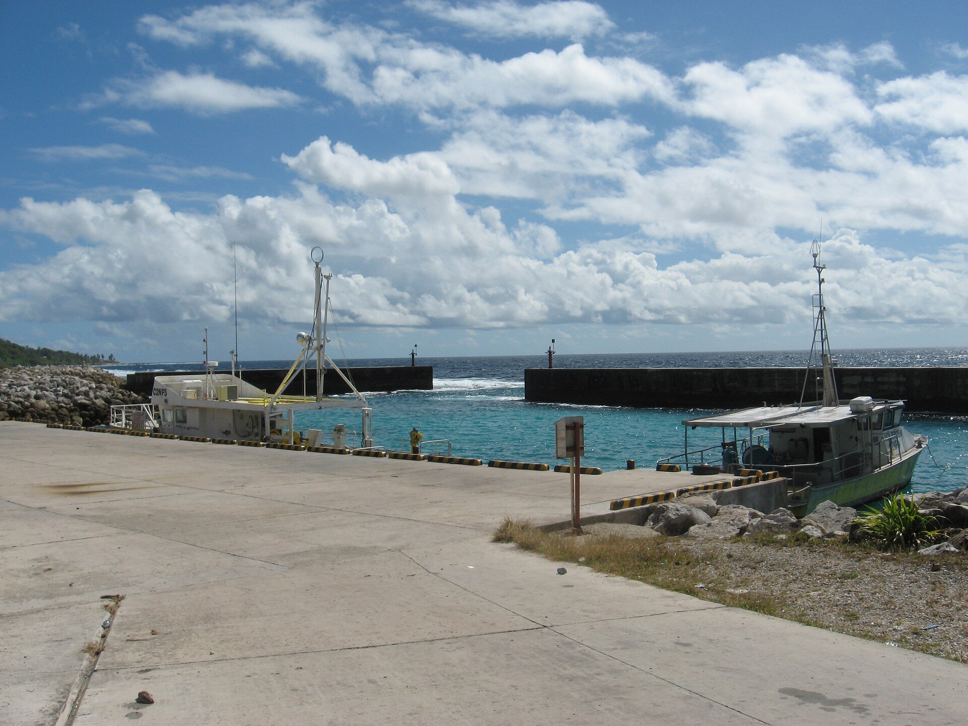
Plan on one to two hours for a walk and a swim. It suits early risers, photographers and anyone who wants quiet time by the sea. Sea currents along this coast can be strong, so ask your host or local people where it is safe to swim before you get in, and take care on the reef.
Natural sights
Buada Lagoon
Inland in the Buada district, this small freshwater lagoon is one of the few places on the island where trees and green growth flourish thickly. A shaded path runs around its edge, and the contrast with the stripped plateau nearby is striking.
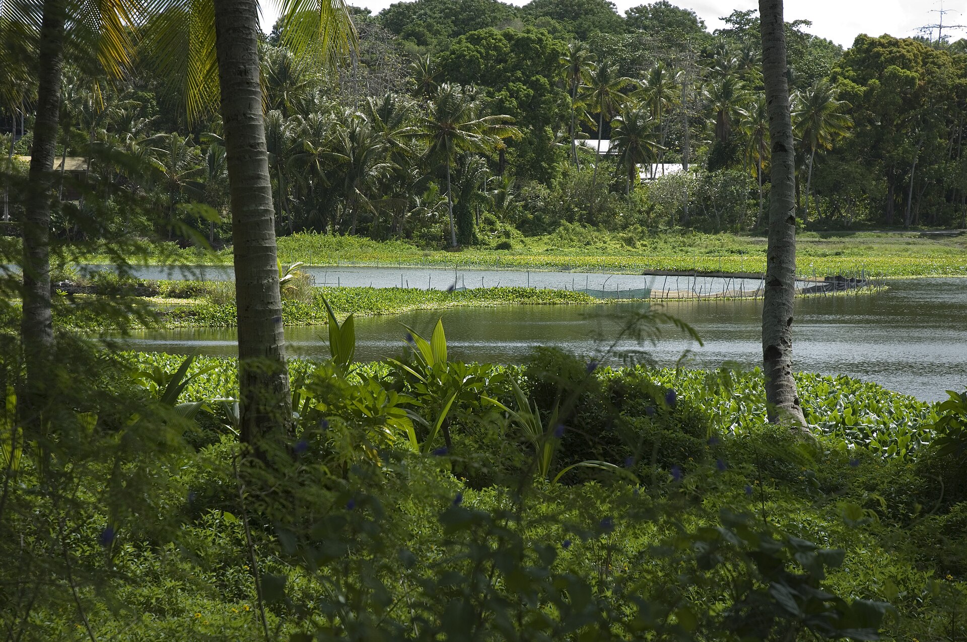
Allow about an hour to walk around it and sit quietly. It is a good choice for families, birdwatchers and slow-paced travellers. Check locally before swimming, because the lagoon is a community landscape and not a managed swimming area.
Moqua Caves and Moqua Well
In the Yaren district, near the airport and the government buildings, a set of limestone caves leads down to Moqua Well, a freshwater pool beneath the island’s raised coral. The caves are cool and damp, with rock formations overhead and still water below, and they once served as a water source for the community.
A visit takes about 30 to 60 minutes. It appeals to geology fans and curious adventurers, and you should wear shoes with grip, carry a torch and ask permission, since the site has local significance. I could not confirm current opening arrangements, so check with your accommodation before you go.
History and landscape
Command Ridge
Command Ridge, between the Aiwo and Buada districts, is generally given as the island’s highest point at about 65 metres. During the Japanese occupation it held a communications bunker, and the concrete shell, rusting artillery and Japanese writing on the walls survive, with views across the whole island from the top.
Set aside about an hour. History enthusiasts get the most from it, and it is best in the cooler part of the day. Paths can be overgrown and uneven, so wear closed shoes and ask a local guide or your hosts for directions.
Japanese coastal guns and bunkers
Wartime relics are scattered around the island, from large coastal defence guns to pillboxes and bunkers half hidden in the vegetation. Several are found near Anibare Bay and the Menen Hotel area, and others lie along the ridge, so they combine easily with a coastal drive.
Expect 30 to 90 minutes depending on how many you seek out. These are historic sites in a living community, so stay on obvious tracks, do not climb on corroded metal and treat memorials with respect.
Topside, the mined plateau
The central plateau, known as Topside, was strip-mined for phosphate, leaving fields of jagged limestone pinnacles that resemble a lunar surface. Mining largely stopped when the best reserves ran out, and rehabilitation is a long-term effort.
A drive or guided walk takes about one to two hours. It is best for travellers interested in the island’s economic story, and the stark landscape looks most dramatic in low afternoon light. The ground is sharp and hot, so wear sturdy footwear and carry water.
Cities and civic life
Yaren district
Yaren is the nearest thing Nauru has to a capital. It holds Parliament House, government offices and the airport, and the Moqua Caves are on its doorstep. The district has a small museum and everyday island life, and it makes a convenient base for a first morning.
One to two hours is enough for a stroll and a look around, and it suits visitors who like seeing how a tiny nation runs itself. Opening hours for the museum were not confirmed, so ask locally before you plan around it.
How to combine the sights
The coastal road circles the whole island, so most sites sit within a short drive of each other. A relaxed first day can take in Yaren and Moqua Well, then Buada Lagoon and Command Ridge, while a second day covers Anibare Bay and the wartime guns before a sunset at the harbour.
Best Places FAQs
What is the best beach in Nauru?
Anibare Bay is the island’s best-known and longest beach, about two kilometres on the east coast. Currents can be strong, so ask locally before swimming and treat the reef carefully.
How many days do you need in Nauru?
Two to three days is enough to see the main sights at an unhurried pace. The island is small, but flight schedules and slow, relaxed pacing often shape how long visitors stay.
Can you see World War II relics in Nauru?
Yes. Japanese guns, bunkers and pillboxes survive around the island, and Command Ridge holds a communications bunker with Japanese writing. Treat them as historic sites, and ask locals for access and directions.
Are there guided tours?
Small local operators and hotels may arrange guides or drivers. Official listings were not confirmed, so contact the Nauru Tourism Corporation, which answers visitor enquiries, or ask your accommodation to help before you arrive.